GIS Projects
In this GIS Projects, Beladona collaborated with Dinas Pertanahan dan Tata Ruang (Dispertaru) DIY for Updating Geospatial Data for the Inventory of Sultan and Pakualaman Grounds in Special Region of Yogyakarta and also collaborated with Dinas Pertanahan dan Tata Ruang (DPTR) Kota Yogyakarta for Evaluation Study of Spatial and Land Use in Yogyakarta City
In order to control spatial and land utilization, the Yogyakarta City Land and Spatial Planning Agency (DPTR) conducts a Study of Spatial and Land Utilization Evaluation. This is partly due to the fact that land has characteristics that do not increase quantitatively. Land quantity is decreasing, and its quality is declining. Therefore, to meet human needs, provide optimum benefits, and have sustainable characteristics, land use management is necessary.
The study encompasses the following:
1. Compiling and aligning survey data on land use types into an Excel sheet and linking it with spatial data in a GIS database.
2. Updating the GIS spatial database using survey data on how land is used in completed local surveys.
3. Analyzing how well existing land use in 45 urban villages fits with the RDTR using a matrix in areas where spatial land use databases are finished.
4. Creating 45 maps showing how land is currently used and how well it aligns with the RDTR based on the analysis in point 3.
5. Checking land ownership types through the Ministry of ATR/BPN geoportal for each area marked on the working maps.
6. Analyzing land availability based on the ownership types found in point 5 and creating 45 maps based on land availability.
7. Creating the final report.
Here is one of the working maps used for the survey along with the survey results that have been conducted.


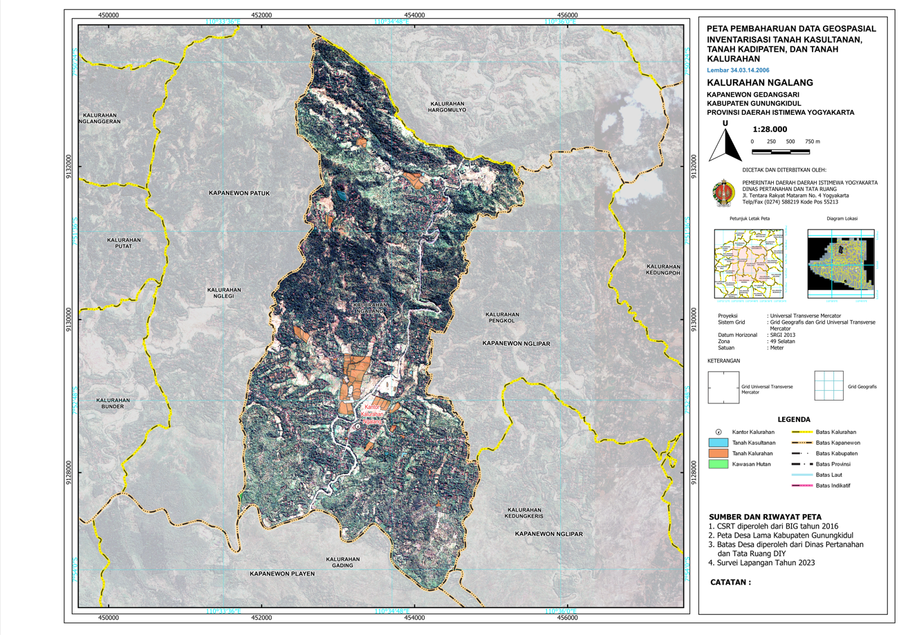
In the implementation of the Special Affairs of Land Affairs for the Fiscal Year 2023, the Regional Government of Yogyakarta Special Region through the Yogyakarta Land and Spatial Planning Agency carried out activities for the Updating Geospatial Data for the Inventory of Sultan and Pakualaman Grounds. The purpose of this activity is to support the implementation of the One Map Policy and Single Base Map policies organized by the Central Government and the Regional Government of Yogyakarta Special Region by recording the positions (plotting) of Sultan and Pakualaman grounds coordinates.
The scope of this activity includes:
1) Participating in delimitation processes with the local government to revise the boundaries of Sultanate Grounds parcels.
2) Conducting surveys to update Sultanate Grounds in accordance with agreements reached during the delimitation process.
3) Preparing 97 work maps and administrative documents as materials for the delimitation process.
4) Managing the geodatabase for the survey data obtained from Sultanate Grounds.
5) Conducting layouting as the final product of updating the geospatial data for Sultanate Grounds.
Here is one of the working maps used for the survey along with the map layout resulting from the survey activity.